 Simultaneous localisation and mapping (SLAM) is the problem of determining the position of an entity (localisation), such as a robot, whilst at the same time determining the structure of the surrounding environment (mapping). This has been a major topic of research for many years in Robotics, where it is a central challenge in facilitating navigation in previously unseen environments. Recently, there has been a great deal of interest in doing SLAM with a single camera, enabling the 6-D pose of a moving camera to be tracked whilst simultaneously determining structure in terms of a depth map. This has been dubbed ‘monocular SLAM’ and several systems now exists which are capable of running in real-time, giving the potential for a highly portable and cheap location sensor.
We have the following projects running on real-time visual SLAM:
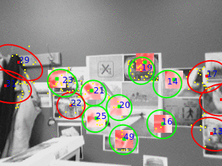
- Robust feature matching for visual SLAM: Matching image features reliably from frame to frame is a central component in visual SLAM. This project is looking at designing new techniques to achieve more robust operation by utilising image descriptors and making use of the estimated camera pose to achieve matching which has greater robustness to changes in camera viewpoint.
- Extracting higher-order structure in visual SLAM. Previous visual SLAM algorithms are based on mapping the depth of sparse points in the scene. This project is looking at expanding the SLAM framework to allow the mapping of higher-order structure, such as planes and 3-D edges, hence producing more useful representations of the surrounding environment.
Our SLAM system is also the central component in the ViewNet project.
You can view an introduction to visual SLAM – slides from the BMVC Tutorial on visual SLAM given by Andrew Calway, Andrew Davidson and Walterio Mayol-Cuevas.