Jose Martinez Carranza, Andrew Calway
We are working with the problem of simultaneous localization and mapping using a single hand-held camera as unique sensor. Specifically, looking at how to  extract a richer representation of the environment using the map generated by the system and the visual information obtained with the camera.
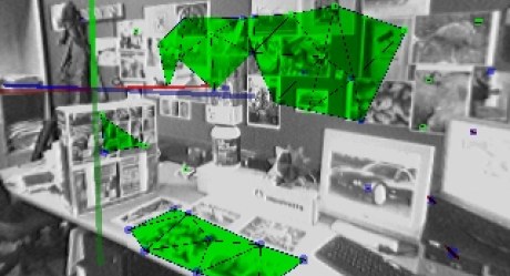
We have developed a method to identify planar structures from the environment using as basis the cloud of points generated by the slam system and the appearance information contained in the images captured with the camera. Our method evaluates the validity of points in the map as part of a physical plane in the world using a statistical frame work that incorporates the uncertainty of estimations for both camera and the map obtained with the typical EKF based visual slam framework. Besides of the benefits of a better visual representation fo the map, we are investigating how to exploid this structures to improve the estimation.
